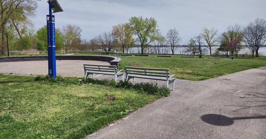
The Bronx has more waterfront than almost any part of New York, and less access to it than almost anyone would believe. For a century its shoreline was given over to rail yards, highways, wholesale markets and waste transfer stations, the essential and unlovely machinery that keeps the rest of the city fed and functioning. The water was there; the public, for the most part, was not invited.
The city now proposes to change that, at least for those on foot and on two wheels. The Department of Transportation has announced the start of planning for a Bronx Waterfront Greenway, a roughly 15-mile corridor running from Randall’s Island Park to SUNY Maritime College at Fort Schuyler. The route is meant not only for weekend recreation but for commuting, with the agency singling out easier trips to the jobs of Hunts Point.
Wednesday Night in Hunts Point
The first public workshop is scheduled for Wednesday, Nov. 4, from 6 to 8 p.m. at the BankNote Building, 1231 Lafayette Avenue—a fittingly Bronx venue, the former American Bank Note Company printing plant now home to offices and nonprofits a short walk from the produce market. It is, in the city’s telling, the beginning of a conversation rather than the unveiling of a plan, and those who intend to argue about where the route should run would do well to show up early in the process, when the lines on the map are still in pencil.
The Bronx effort is one of several outer-borough greenway studies the city announced together. In Brooklyn, planners are looking at a route along Ocean Parkway and Eastern Parkway. On Staten Island, a waterfront corridor would run about ten miles from the Goethals Bridge to the Verrazzano. In Queens, a Southern Queens Greenway would connect Spring Creek Park and Brookville Park.
How It Gets Paid For, and When
The planning work is funded by a federal RAISE grant awarded in 2022, according to the DOT announcement, and the city expects to complete six corridor plans by 2028. The approach is a familiar one for the agency: near-term improvements built with pavement markings, signs and limited concrete, followed by longer-term capital projects that require real construction money and real construction time.
That two-speed model invites the obvious objection that paint is not protection. But it has the virtue of producing something visible within a mayoral term, which in New York is not a trivial consideration. A greenway that exists only as a report in 2028 is a greenway that will be rewritten by the next administration.
Building on What Is Already There
The Bronx route will not start from nothing. The DOT announcement points to the recent redesign of Bailey Avenue and the Harlem River Greenway, now under construction, as foundations for the larger network, and frames the new studies as the next step after the citywide greenway plan released in 2025. The department’s commissioner, Mike Flynn, the Parks commissioner, Tricia Shimamura, and the Economic Development Corporation’s president, Anthony Shorris, all lent their names to the announcement, presenting the corridors as a joint effort among agencies with overlapping claims on the waterfront.
That joint billing matters more than it might seem. The Bronx shoreline is a patchwork of jurisdictions—city parks, state highways, private industrial parcels, rail rights-of-way—and any continuous path along it will have to negotiate every one. Fifteen miles is a long way to go without running into someone’s fence.
The Bigger Picture
There is a larger argument embedded in the plan. For decades the South Bronx was asked to host the infrastructure the rest of the city preferred not to see, and its residents bore the consequences in air quality and isolation from the water. Projects like the Randall’s Island connector and the parks at Barretto Point and Soundview have begun to reverse that history in pieces. A continuous greenway would turn the pieces into a system.
Whether the city can deliver it is another matter. Greenway plans have a way of lingering, and the Bronx has seen its share of renderings that never left the easel. But the commitment to six plans by 2028, the federal money already in hand and a workshop on the calendar give the effort more substance than most.
For the moment, the useful thing to know is the date: Wednesday evening, at the BankNote Building. The city has asked the Bronx where it wants to walk and ride along its own water. It is a question worth answering in person.
Featured image: Soundview Park on the Bronx waterfront. Photo by Jim Henderson via Wikimedia Commons, CC BY-SA 4.0.



Leave a Reply